Category:The Loup
Jump to navigation
Jump to search
village in United Kingdom  | |||||
| Upload media | |||||
| Instance of | |||||
|---|---|---|---|---|---|
| Location | Northern Ireland | ||||
 | |||||
English: The Loup is the name of a small village and the surrounding area in County Londonderry, Northern Ireland. It is a rural region with a small village at the heart of it. The Loup lies on the western shores of Lough Neagh with relatively close proximity to Cookstown, Magherafelt and Dungannon. The Loup lies close to the border with County Tyrone and beside Ballinderry. It is part of Cookstown District Council and Social Democratic and Labour Party (SDLP) councillor Mary Baker is from the area.
Media in category "The Loup"
The following 24 files are in this category, out of 24 total.
-
 Ballyeglish Church of Ireland - geograph.org.uk - 300818.jpg 640 × 479; 71 KB
-
 Ardagh Road - geograph.org.uk - 270906.jpg 640 × 292; 28 KB
-
 Ballyboyle Townland - geograph.org.uk - 270874.jpg 640 × 479; 64 KB
-
 Ballygroby Townland - geograph.org.uk - 300839.jpg 640 × 479; 48 KB
-
 Ballygroby Townland - geograph.org.uk - 300840.jpg 640 × 479; 48 KB
-
 Ballygrooby Lane - geograph.org.uk - 300822.jpg 640 × 479; 73 KB
-
 Ballymoyle Townland - geograph.org.uk - 267318.jpg 640 × 479; 55 KB
-
 Ballynenagh - geograph.org.uk - 300814.jpg 640 × 279; 31 KB
-
 Ballynenagh Orange Hall - geograph.org.uk - 520866.jpg 640 × 480; 53 KB
-
 Ballynenagh Townland - geograph.org.uk - 300809.jpg 640 × 479; 54 KB
-
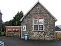 Church school at The Loop - geograph.org.uk - 300808.jpg 640 × 479; 64 KB
-
 Cloverhill Road - geograph.org.uk - 267322.jpg 640 × 479; 63 KB
-
 Gortagilly Hill - geograph.org.uk - 520861.jpg 640 × 479; 71 KB
-
 Killowen Hill - geograph.org.uk - 520821.jpg 640 × 479; 83 KB
-
 Knocksallagh - geograph.org.uk - 520840.jpg 640 × 479; 90 KB
-
 Lanaglug Townland - geograph.org.uk - 270866.jpg 640 × 479; 58 KB
-
 Lanaglug Townland - geograph.org.uk - 270868.jpg 640 × 479; 54 KB
-
 Loup A.O.H. Hall - geograph.org.uk - 338208.jpg 640 × 479; 63 KB
-
 Road at Ballygroby - geograph.org.uk - 300841.jpg 640 × 479; 42 KB
-
 Road at Ballygroby - geograph.org.uk - 300843.jpg 640 × 479; 85 KB
-
 Road at Ballynenagh - geograph.org.uk - 520870.jpg 640 × 479; 48 KB
-
 Road at Mawillian - geograph.org.uk - 267282.jpg 640 × 479; 83 KB
-
 The Hollow - geograph.org.uk - 338212.jpg 640 × 479; 61 KB
-
 The Loop RC Church - geograph.org.uk - 300801.jpg 640 × 479; 47 KB


